Property/Homeowners
Please review the brief descriptions below and select your area of interest for further information.
Mortgage Inspections
A Mortgage Inspection is a very basic sketch showing the Surveyor’s opinion of the location of the major improvements on a parcel of property. This product is generally used by lenders to limit liability through the Surveyor’s opinion that the components of the property are located on the deeded property. This instrument does NOT constitute a boundary survey or estimate of property lines.
Boundary Surveys
A Boundary Survey is a detailed measurement of the property with the property corners being marked on the ground. This survey can also include a legally binding drawing of the property’s boundary and major improvements.
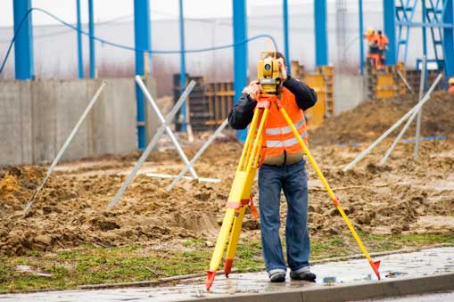
Mapping / Topographic Surveys
A topographical survey is a detailed measurement of a specific area that is plotted onto a drawing to show the relationship of features on the ground to each other. These maps may or may not include elevations and/or boundaries.
Zoning / Permitting Assistance
Local municipalities, the State of Virginia, and the Federal Government issue zoning ordinances and laws for the control of the use of land. Burgess Surveying can help you navigate through the approval process.
Descriptions of Property
A Description of Real Property is the text that legally defines the property. Burgess Surveying can help you find, understand, interpret, and/or write your property’s legal description.
Land Divisions / Property Splits
The parcel split process is used to divide parcels into smaller units, usually for sale. In some cases, a lot line adjustment may be use between adjoining parcels.
Mortgage Inspections
A Mortgage Inspection is a very basic sketch showing the Surveyor’s opinion of the location of the major improvements on a parcel of property. This product is generally used by lenders to limit liability through the Surveyor’s opinion that the components of the property are located on the deeded property. This instrument does NOT constitute a boundary survey or estimate of property lines.
Boundary Surveys
A Boundary Survey is a detailed measurement of the property with the property corners being marked on the ground. This survey can also include a legally binding drawing of the property’s boundary and major improvements.
Mapping / Topographic Surveys
A topographical survey is a detailed measurement of a specific area that is plotted onto a drawing to show the relationship of features on the ground to each other. These maps may or may not include elevations and/or boundaries.
Zoning / Permitting Assistance
Local municipalities, the State of Virginia, and the Federal Government issue zoning ordinances and laws for the control of the use of land. Burgess Surveying can help you navigate through the approval process.
Descriptions of Property
A Description of Real Property is the text that legally defines the property. Burgess Surveying can help you find, understand, interpret, and/or write your property’s legal description.
Land Divisions / Property Splits
The parcel split process is used to divide parcels into smaller units, usually for sale. In some cases, a lot line adjustment may be use between adjoining parcels.
Other Commercial Services
For more information on pricing and services available for the following:
- Commercial / Business
- Attorneys
- Banks/Realtors/Lenders
